
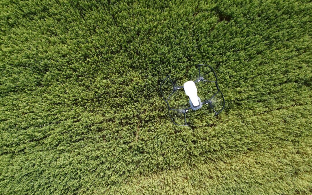
Drone field mapping has made a big difference in how growers manage their crops, especially in larger operations. It helps pinpoint plant health problems faster, lays out data more clearly, and allows for better, more timely decisions. But as crops grow thick and tall during peak growing season, the accuracy of those maps can start to drop. That dense vegetation can block signals, throw off sensors, and make it harder for drones to measure what’s beneath the canopy.
Around September in Texas, many growers are deep into the late stages of growth for crops like cotton, corn, and sorghum. This stage is critical for decision-making. Missing moisture stress, pest problems, or gaps in nutrient coverage could cost you quality and yield. That’s where precision drone mapping really shows its value if it’s done right. When working through layers of growth, your drone systems need to be adjusted and prepared to keep the data reliable.
Understanding Field Mapping Challenges
Dense crop growth can cause a handful of mapping issues that are easy to overlook if you’re not prepared. While the drone might be following the same flight path from earlier in the season, the conditions have shifted. Those once-clear rows are now hidden under leaf canopies. Sunlight hits sensors differently. Altitude settings that worked fine before can lead to blurred images now. And interruptions in satellite signals become more common.
Some of the most common problems growers run into are:
– Inaccurate elevation data due to interference from tall crop cover
– Reduced imaging clarity because of uneven light filtering through leaves
– Loss of GPS or RTK signal while flying over remote or obstructed fields
– Slow or failed data transfer when the drone is overwhelmed by too many data points
Let’s say you’re flying over a mature cotton field. Early in the summer, the rows were fairly visible from above, making it easy for the drone to scan the plants and collect clean images. Now, with thick plant growth and overlapping leaves, that same field looks like an entirely different landscape. Sensors have to work harder to separate one plant from another. If flight speed and altitude stay the same, you might end up with overlapping shots that don’t align or stitched maps that miss key data.
The greater the crop density, the more likely your drone setup will need to be adjusted. In most cases, the issues aren’t caused by one single thing failing. It’s usually a mix of flight settings, environment, and sensor limitations working against each other. That’s why it helps to know not just what can go wrong but how to set things up right from the start.
Techniques For Improving Mapping Accuracy
When crops grow tall and dense, the right drone settings can make all the difference between a sharp, readable map and one that’s full of gaps or fuzzy detail. Every field is different, but there are some go-to adjustments growers in Texas can use to get more dependable results during late-season scouting.
Start with altitude. Lowering the flight height can help reduce distortion from shadows or uneven crop height. But go too low and you’ll risk chopping off portions of the field or missing overlapping images. Finding that balance takes a bit of trial and error, but sticking to a consistent pattern and gradually adjusting helps get you there.
Next, pay attention to overlap settings. Thick leaves and dense rows create more shadows and obstructions, so increasing the front and side overlap between images will help build a complete picture when the software stitches everything together. You don’t have to max it out, but small boosts in overlap usually tighten up image quality.
Other things to focus on:
– Calibrate sensors before flight, especially if you do flights at different times of day or under changing cloud cover
– Make sure lenses are clean before every flight
– Test your sensors for heat interference during long flight days to maintain camera consistency
– Use height-above-ground mode, if available, to keep flight elevation stable across varying terrain
– Select mapping software that can adapt to late-stage plant growth and recognize crop-specific shapes
Maintenance plays a big role too. Batteries wear down faster under high heat, which is common in early September in Texas. Make sure there are backups charged and ready, and that every part of the drone has been inspected before scouting a dense canopy. A clogged air vent or a misaligned sensor bracket might seem small, but both can throw off precision mapping and cost time.
Benefits Of Accurate Field Mapping
Good data is half the battle when it comes to smart crop decisions. A cleaner map of the field makes it easier to see where stress is setting in, where weeds might be winning, or where nutrient application didn’t hit evenly. Without an accurate reading, it’s like trying to guess what’s under a thick layer of cotton or corn just by sight. That leads to delayed responses, wasted product, or skipped patches.
The better your image quality, the more likely you’ll be able to spot subtle changes like:
– Leaf discoloration indicating nutrient stress
– Wilted canopy sections from irrigation issues
– Unexpected crop gaps that could signal pest activity
Field maps also help save on inputs by avoiding treatment across the whole field when it’s not needed. Instead of a wide-area application, you can identify and treat zones that need attention. That means your time, labor, and spray go to the areas that actually matter.
Take a field of late-stage sorghum, for example. With good drone maps, you can clearly see how one end of the field is thriving, while another zone near a shaded tree line is hurting. That could be due to water pooling or reduced sunlight. With that kind of insight, you can fix the cause instead of just reacting to the symptoms with more product.
Practical Tips For Crop Scouting With Drones
If you’re new to mapping during heavy growth or just looking to clean up your process this season, having a step-by-step setup can help. Here’s a simple routine to follow before heading out to the field:
1. Check weather conditions and avoid high winds or shifting clouds that affect light exposure
2. Fully charge all drone batteries and prep extra ones just in case
3. Clean all sensor lenses and double-check for any software updates or alerts
4. Set a programmed flight route with adjusted altitude and overlap
5. Perform a short test run to verify image clarity before launching full mapping
6. Let the software process a preview map to catch stitching issues early
Texas growers in September should also keep an eye on how heat affects drone behavior. Adjust breaks between flights if needed, especially when working in back-to-back fields. Heat waves can mess with battery stamina and sensor performance more than you’d expect.
Lastly, try scoping fields at consistent times, like early morning or late afternoon. Light levels stay more stable and the plants aren’t under peak stress, which can alter how reflectance sensors pick up vegetation quality.
How Osprey Agri Drones Can Help You
Managing drone field mapping during heavy crop growth takes strategy, experience, and the right tools. At Osprey Agri Drones, we specialize in helping growers get the most out of their drone systems when it counts. Whether you’re having signal issues, need help adjusting flight settings, or want drones that are purpose-built for agricultural scouting, we’ve got you covered.
Our lineup includes reliable drones with field-tested sensors, customizable flight software, and data solutions designed to break through even the thickest canopies. We offer training, setup, and ongoing support so you’re never going into a dense growth season unprepared.
From cotton surveys to corn and sorghum scouting, our drones are optimized for accuracy during the toughest mapping conditions in Texas. If you’re looking to improve your late-season decision-making and avoid common mapping mishaps, Osprey Agri Drones is ready to help.
Why Better Mapping Matters at Harvest Time
Mapping accuracy during peak crop growth isn’t out of reach. It just takes small adjustments and a bit of planning. When your drone settings match the growth stage and conditions of your field, every scouting flight becomes more useful. Photos are clearer, maps hold tighter details, and decisions become easier to make.
As Texas growers head into fall harvest stages, being able to trust drone data matters more than ever. It means saving on inputs, targeting real problems, and building a better read for next season. Start by tuning up the settings, walking your fields, and committing to regular checks. The more precise your scouting, the more your harvest responds.
Ready to take your crop management to the next level? Learn how Osprey Agri Drones can support you with tools built to perform even in the thickest vegetation. Discover the advantages of crop scouting with drones and start making better decisions across your fields today.