
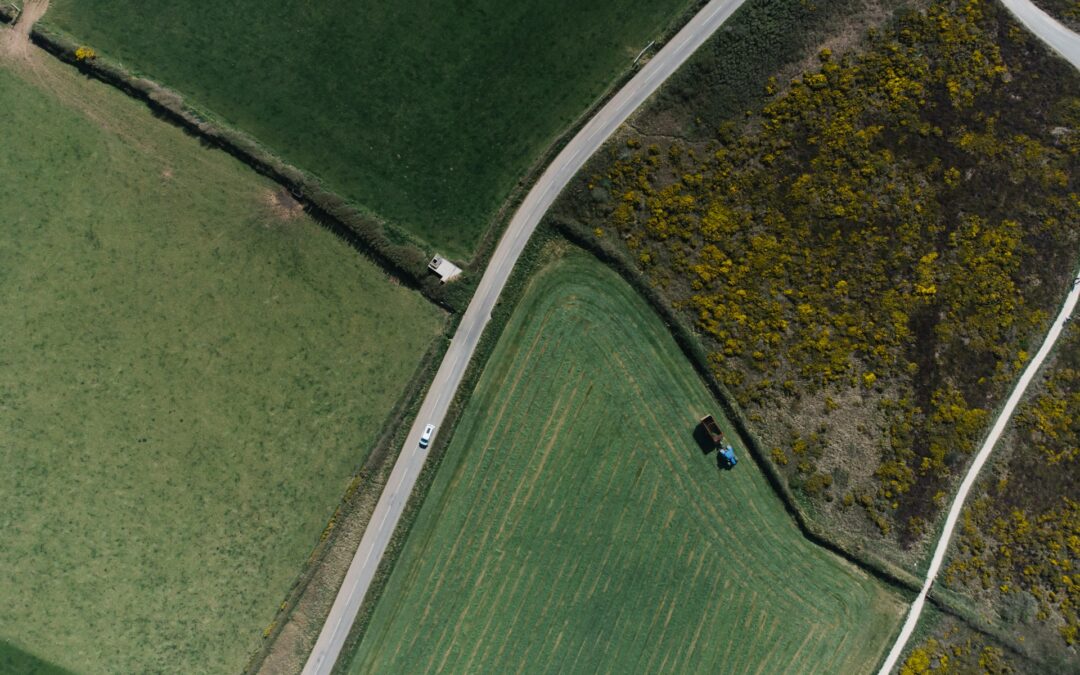
Keeping up with changing conditions across large fields in Texas isn’t easy. Different crops, soil types, and growing stages make it even tougher to manage everything the way you want. That’s why more growers are using drone-based mapping tools to stay ahead of the curve. These tools give you sharp, meaningful views of your land in far less time than older manual methods. They don’t just capture images. They help you find issues quicker, make smarter decisions, and get the most out of each season.
One tool that’s drawing attention for farm mapping is the DJI Mavic 3M. Compact but powerful, this drone is built with farming in mind. Its features make it a solid fit for growers in Texas who want to improve how they track crop health, monitor soil changes, or spot head-start opportunities before they show up on the ground. Whether you’re planting cotton or managing hay fields, the Mavic 3M helps you work smarter by putting up-to-date field data in your hands.
Benefits Of Smart Mapping Solutions In Farm Management
It’s hard to keep track of everything going on across hundreds of acres, especially when changes happen fast. Heat stress, pests, or moisture issues can show up quickly and throw off your progress. That’s where smart mapping can really help. Drones don’t just fly over your land. They gather real-time visual and data-driven insights that outline what’s working and what needs attention. This way, you can focus your time and energy on the areas that actually need it.
Here are a few of the direct benefits smart mapping solutions offer to Texas farmers:
– Better crop monitoring: Drones like the DJI Mavic 3M capture high-level overviews and zoomed-in field snapshots. You can scan rows for weak spots or flag areas where growth is lagging behind.
– Early pest and disease detection: Remote sensing picks up on small color changes in plants that often signal problems, which means you can act before visible damage spreads.
– Smarter resource allocation: You see where to increase irrigation or ease off. This helps stretch your inputs without wasting them on the wrong spots.
– Timely planning across growing seasons: Observing how your field changes month to month helps you plan better for upcoming rotations or fertilization.
– Visual proof for field decisions: Whether you’re speaking with your team or crop consultant, detailed maps strengthen how you explain field conditions and decisions.
Instead of guessing, you’re working with data that shows exactly what’s happening around your fields. It’s a difference you can see and rely on.
Features Of The DJI Mavic 3M For Agricultural Use
The DJI Mavic 3M brings together imaging tech and mapping software in a drone that’s light enough to carry and tough enough for daily field use. This makes it ideal for farmers in varied Texas conditions where some days are windy, others blistering hot, and some require fast decision-making out in the field.
Here’s what makes the DJI Mavic 3M stand out for farm management:
– Multispectral camera: This picks up light changes not visible to the eye, which means it’s great for plant health checks or scouting trouble spots.
– RGB camera: High-resolution color imagery helps you zero in on field details, such as weed spread or irregular growth.
– RTK positioning: Precise GPS tech keeps your maps accurate and aligned, great for repeat checkups on the same field blocks throughout the season.
– Long battery life and fast charging: You can complete field scans in fewer flights, saving you time throughout the day.
– Compact design with foldable arms: Easy to transport between sites or from truck to field without any setup hassle.
One Texas sorghum grower shared how they shortened their weekly walk-throughs by flying this drone over their plots instead. With detailed image layers and mapping breakdowns, they didn’t need to stop at every point in person. They focused only where they knew it mattered. That’s the kind of time savings most farmers can get behind.
With features like these, the Mavic 3M helps make better field management a lot more doable, even on a tight schedule. It’s built for speed, accuracy, and results that matter to hands-on growers.
Practical Applications Of DJI Mavic 3M In Texas Farms
The DJI Mavic 3M isn’t a one-size-fits-all piece of gear. It works across different crops and growing styles, adapting easily to what your farm actually needs. Since it’s summer in Texas when this article goes live, a lot of attention will be on heat stress, water use, and early prep for late-season crops. The Mavic 3M helps keep tabs on these areas without needing to be on the ground all day.
Here’s how Texas producers can put this drone to work across different farm types:
– Cotton: Late-season weed pressure and irrigation gaps are easier to locate from above. Multispectral data picks up stressed sections before they’re visible to the eye.
– Wheat: Spotting signs of rust or nutrient deficiencies early helps protect yields. Scans become especially useful ahead of harvest to adjust cutting paths, saving fuel and time.
– Hay fields: With repeated flights, you can plan ideal cutting times and monitor regrowth after each bale cycle. Drone mapping lets you oversee renewal speed without guessing.
By linking regular drone scans with conditions on the ground, you start building a reliable field view month to month. For dry years, that means fewer surprises. In wetter seasons, you’ll know which areas are likely to flood or hold too much moisture.
When it comes to timing, Texas farmers can fly the Mavic 3M across all seasons. In the summer, it’s great for checking on drought-related plant stress. Once fall rolls in, early canopy checks help set up cover crop planning. Winter flights help track erosion risks, and spring is ideal for spotting patchy emergence. The drone’s value sticks around year-round, not just at planting or harvest.
Maximizing Efficiency With Drone-Based Mapping
Getting started with the DJI Mavic 3M doesn’t require fancy prep or complex setups. But turning field images into useful actions does take consistent steps. Once you build a system around flying and analyzing your fields, the process gets pretty straightforward.
Try these simple steps to get the most out of every flight:
1. Chart your fields using known landmarks.
2. Start with a basic scan every 7 to 10 days to spot major changes.
3. Organize flight data by crop or field section so you don’t mix variable soil zones.
4. Match your drone maps to your irrigation zones or application maps.
5. Review time-lapse data from previous scans to understand patterns over time.
Regular flights paired with good records go a long way. What was patchy last month might now be a disease pocket, or maybe just different soil moisture. Over time, you’ll be able to pinpoint which areas always need extra help and which consistently perform without issue.
The long-term upsides can be seen in less wasted effort. You’ll likely cut back on unnecessary passes or inputs. You also reduce the time spent walking or guessing what part of the field needs attention next. This frees you up to focus on higher-impact tasks or address the unexpected problems that always seem to pop up mid-season.
How Texas Farmers Are Staying Ahead With Smarter Tools
Year after year, it’s the small changes in timing, treatment, and planning that end up shaping success. Smart mapping doesn’t promise overnight miracles. What it does offer is more control throughout the process. Control that helps keep delays, damage, or input waste to a minimum.
Texas growers dealing with heat, unpredictable rainfall, and expanding acre loads can use that kind of help. Having a tool that creates a clear picture of your land, even when you’re not physically out there, makes decisions feel a lot less like guessing. It’s about getting ahead of the curve before the curve shifts again next week.
Drone mapping, especially with tools like the DJI Mavic 3M, brings real, down-to-earth solutions. Whether it’s managing resources better or staying sharp through another dry spell, smarter aerial insights give farms a clearer shot at finishing the season strong. And while the learning curve is always there, it’s much smaller when the tech keeps pace with what the land asks from you.
If you’re looking to make faster decisions and manage your farm with better precision, take a closer look at how the DJI Mavic 3M can simplify your field monitoring. At Osprey Agri Drones, we’re committed to helping Texas farmers work smarter with tools that deliver dependable insights and save valuable time each season.